- Jobling Planning +Environment Ltd
- Belfast 028 9590 4942 | Larne 028 2844 0206
murphysquarry
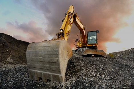
Proposed mineral extraction and restoration by backfilling at Murphy’s Quarry, Magheramore, Dungiven.
WELCOME
Welcome to the Online Community Consultation for Murphy’s Quarry. This Consultation relates to the proposed mineral extraction at lands also known as Magheramore Quarry, located in the townland of Magheramore, Dungiven. The proposed development is for mineral extraction including retention of existing quarried area and proposed extension to existing mineral extraction site and proposed restoration by backfilling with onsite overburden and residual hard rock and associated work. This proposal is needed to sustian the ongoing operaitons of the quarry business.
We are consulting with the local community to obtain initial views on this proposed development to help inform the design process prior to the submission of the planning application later this year.
This Consultation can either be viewed online (from 26th June 2024 to 19th July 2024) or in person on 26th June 2024, at the venue detailed below:
Venue: McAteer Solutions, The Hub, 82 Magheramore Road, Dungiven, BT47 4SP.
Date: Wednesday 26thJune 2024
Time: Drop in anytime between 4 – 7pm
Please take some time to browse the information about the proposal included below and please provide us with your thoughts via the Feedback Form below.
ABOUT OUR PROPOSAL
SITE LOCATION
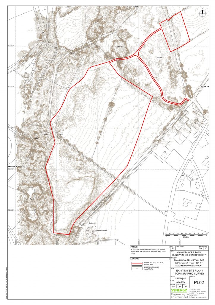
The site is known as ‘Murphy’s Quarry’ and is located some 120m southwest of No. 70 Magheramore Road, Dungiven, in the townland of Magheramore. The proposed application site includes almost 7 hectares of land within the existing quarry area.
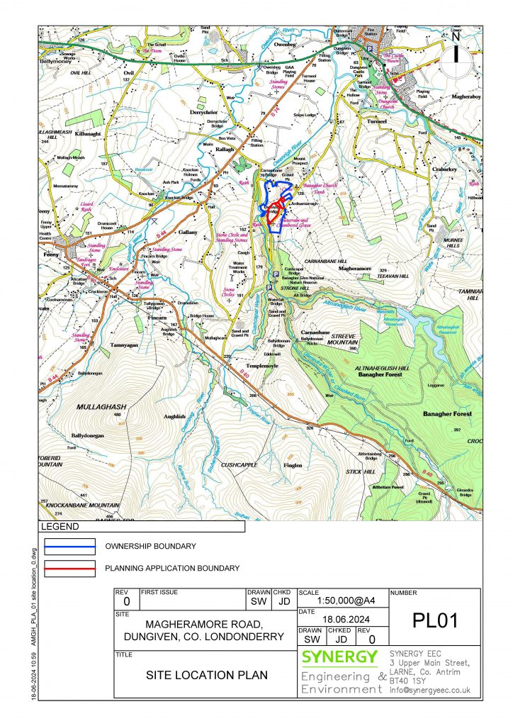
The quarry is located in the countryside and is situated less than 2 miles southwest of Dungiven and approximately 1 mile from Glenshane Road.
BACKGROUND
This site has been operational as a quarry for over 30 years. There have been several planning applications granted during the last 24 years and these are listed below.
| Planning Reference | Description | Status |
| B/2000/0515/F | Sand Gravel Extraction, incorporating processing plant, 2no. settlement ponds, with access road and restoration proposals to return the land to agricultural use | Approved 20/11/2003 |
| B/2006/0240/F | Proposed variation of Condition No 1 of Planning Approval B/2000/0515/F (extraction shall be for a limited period only and shall discontinue by 31 January 2004 and land restored in accordance with approved drawing no.04 on or before 30 April 2004) and the further extraction of sand, gravel & rock and restoration proposals to return the land to agricultural use. | Approved 04/06/2010 |
| LA01/2021/0148/F | Proposed retrospective planning application for extension to previous approval (B/2006/0240/F extraction of sand, gravel and rock.
|
Application Deemed Refusal (ES)
This application lapsed because an Environmental Impact Assessment was not submitted within the 6 month timeframe. It did not assess the suitability of the proposal against planning policy. |
| 2021/E0073 | Appeal Against An Enforcement Notice: The unauthorised winning and working of minerals (quarry), the unauthorised stockpiling of minerals, and the unauthorised stationing of mobile plant, machinery and vehicles | Decision 13/12/ 2022 – PART SUCCESSFUL
The Notice was varied to confirms areas where mineral processing is established and allowed to continue and defined 3 areas [in blue] where quarrying and processing is not permitted. |
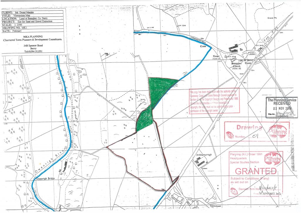
The first planning application for quarrying for quarrying was approved in 2003 under B/2000/0515/F. This was implemented and quarrying occurred for around 10 years. The approved drawing is included below, showing the areas to be quarried in green.
Then an application was submitted to renew and extend that permission to include a larger area of ground. This was then granted in June 2010 and the image belowshows the approved area outlined in red.
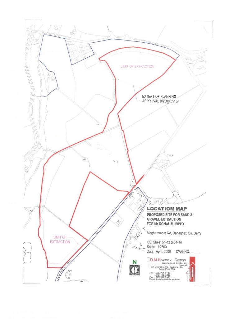
This permission was not properly commenced, and it ultimately expired.
Most recently, there was also a planning enforcement case, which assessed the validity of the ongoing quarrying operations. This determined that most of the quarry outlined in red is allowed to continue to operate for the processing of excavated material, except for the areas hatched in blue on the map below. The yellow shaded areas shows the existing quarry where the mineral processing can continue to operate.
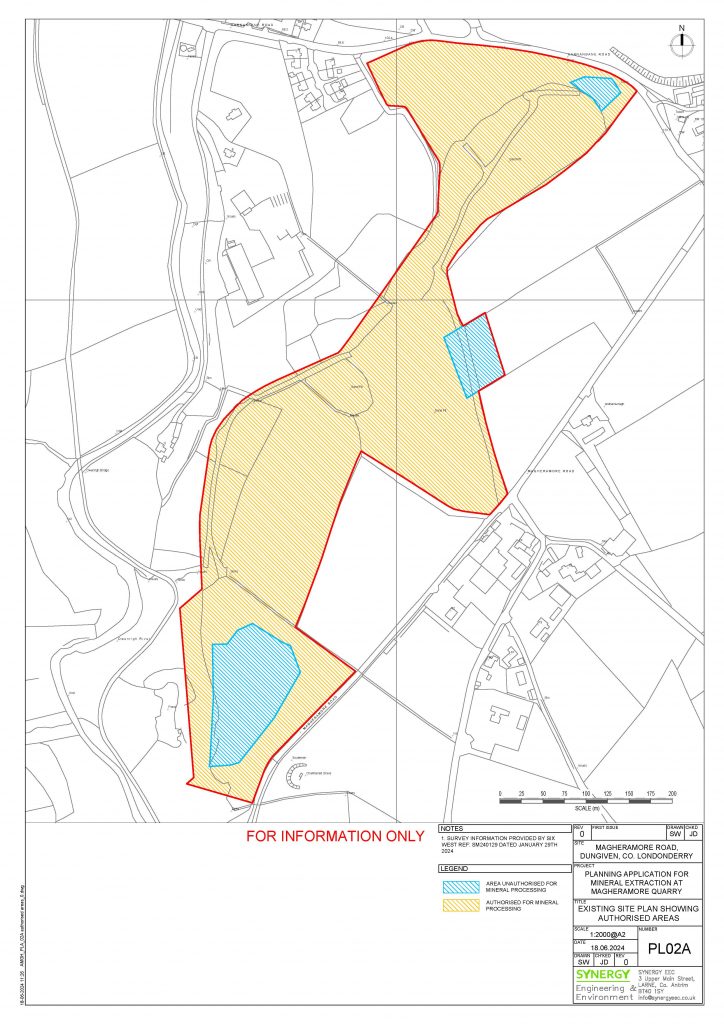
This means Murphy’s Quarry can continue to screen, crush and sell the stone/ gravel that has already been blasted and stockpiled on the site or is brought onto the site hatched in yellow. However, it also means that a new planning application is required for any new excavation of rock at this site or to work in these areas that are hatched blue shown.
This propsal is to address this and to seek planning permisison to restore one of the areas shaded in lue and to continue to quarry in the southern part of the site, as detailed below.
WHATS PROPOSED
This application involves mineral extraction, with restoration. The planning application will be described as:
“Proposed mineral extraction including retention of existing quarried area and proposed extension to existing mineral extraction site (hard rock and sand & gravel) and proposed restoration by backfilling with onsite overburden and residual hard rock and associated works”
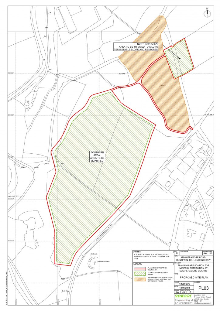
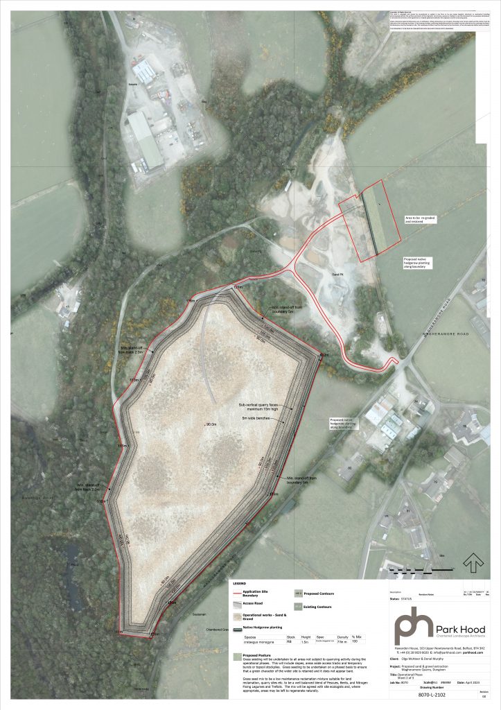
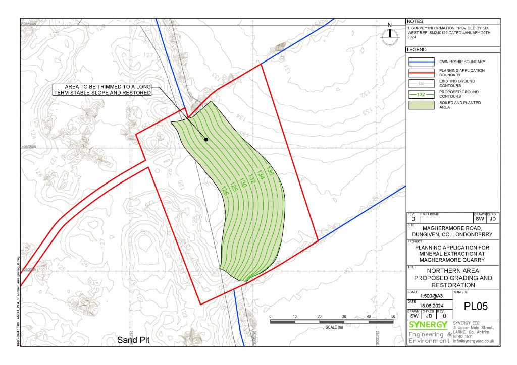
The areas hatched in green below show where the proposed development will take place. The northern green area is part of the old quarry when extraction had taken place and this area is to be restored. The larger green area in the south is where the quarrying is to continue as part of this application.
The lands in orange comprises the existing quarry floor and processing area, which is to be retained.
This proposal essentially invovles two main elements; Mineral Extraction and Restoration. These are detailed below:
1.MINERAL EXTRACTION
The proposal seeks permission for a quarry similar to the previously granted in 2010 under B/2003/0240/F to extract rock from the centre of the site. The main extraction is in the southern half of the quarry andwill include the area detailed below:
This will be excavated using a combination of methods:
i. Mechanical excavation for surface areas to minimise the impact.
ii. Blasting within the quarry void, below surface and away from residential properties.
The extracted rock will then we transported to the existing processing area for screening and crushing, prior to onward sale. The estimated total volume of rock volume to be won is around 1,500,000m3 (circa. 3,300,000 tonnes).
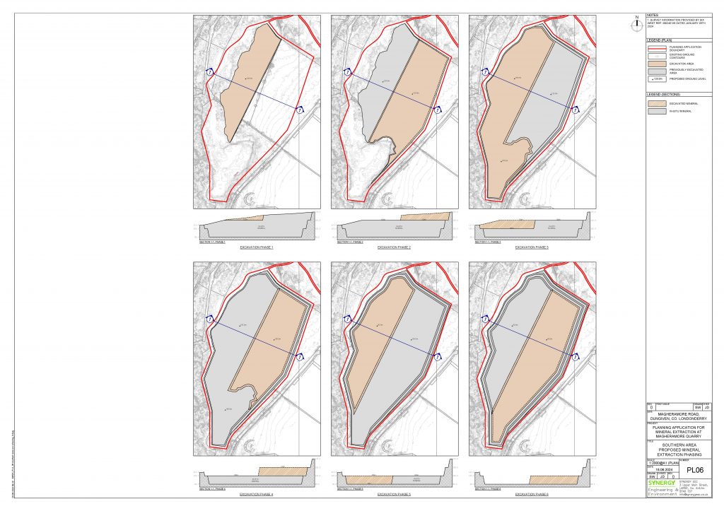
This will take place over approximately 20 years. The following phases are detailed in the image below:
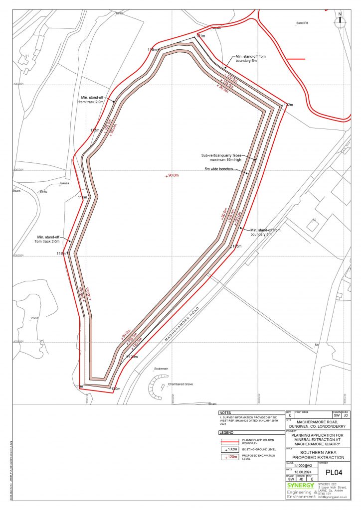
The drawing below provides cross sections through the quarry and shows how deep the quarry will be and how the benches are designed.
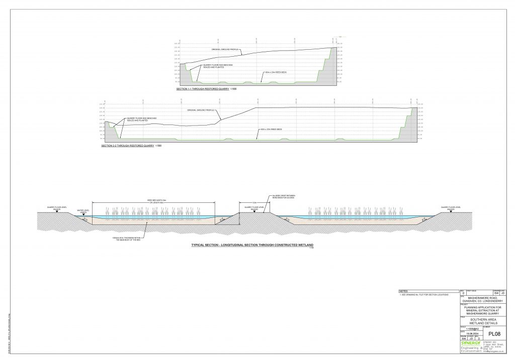
The drawing below shows how the quarry will look during the oepraiotnal phases, i.e. when the extraction is taking place.
2. RESTORATION
The proposal is for a combination of progressive restoration, where practicable and a full restoration strategy upon cessation of mineral operations. This will include various elements, including;
i. Restore the area mid-section of the quarry, which had been subject to sand and gravel removal. This will include the retention of the exposed sad face and new landscaping
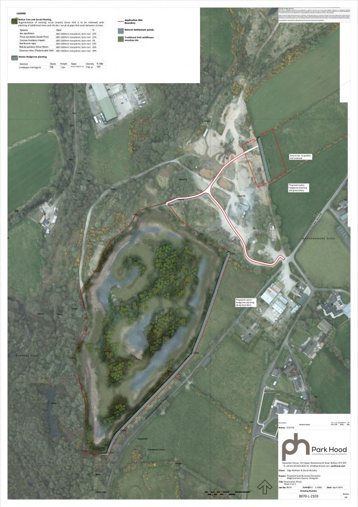
ii. .Create a Wetland Habitat in the area worked quarry floor in the west of the quarry.
iii. Upon completion of the extraction of rock from the southern area, the benches will be backfilled with overburden and planted out. The remains quarry void will be allowed to fill with water to create a second wetland habitat.
The first area to be restored is the mid -section, shaded green in the drawing below:
The proposal also includes a new landscaping around the periphery of the new quarry area, with bunding using the overburden to be removed. This will be carried out in year 1 and will be allowed to colonise and mature, to create a substantial screen and to obscure views into the site form the surrounding area.
The drawing below shows how the quarry will look after the quarry stops and the quarry is restored:
WHAT HAPPENS NEXT?
At the end of this consultation period the applicant, Murphy’s Quarry, intends to submit a planning application to Causeway Coast & Glens Borough Council. In the meantime, we are keen to hear the views of the local community and are carrying out this consultation to help inform the design process prior to submission of the planning application later this year.
Feedback Form